Projects
A selection of my geospatial projects. Click any card to see the full write-up.
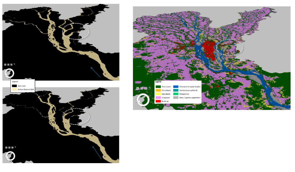
Assessment of Active channel belt Extinct of Mahanadi River
A multi-decadal geospatial analysis of active channel belt dynamics along the Mahanadi River in Cuttack district, Odisha, using Google Earth Engine and 30 years of Landsat satellite imagery to detect, quantify, and interpret fluvial geomorphic change.
[Google Earth Engine] [ArcGIS pro] [Python]

[YOUR PROJECT DESCRIPTION — one or two sentences: what you did, what data you used, and what you found or built.]
Python pandas Folium